Sunday, November 30, 2014

Biomes of China

Map of China's Biomes
China has a wide variety of biomes. The map above shows the biomes that are found in China. Southern China, specifically the province of Yunnan, is interesting because you find tropical biomes in a nontropical area. The rainforest is created farther north by monsoon rainclouds moving into the valleys and creating a tropical climate in the area. Southern and Eastern China's biomes allow for farming and these areas produce many crops, such as rice, wheat and corn. Western China is a unique mix of grassland, mountain and dessert biomes. 

Urban Areas of China

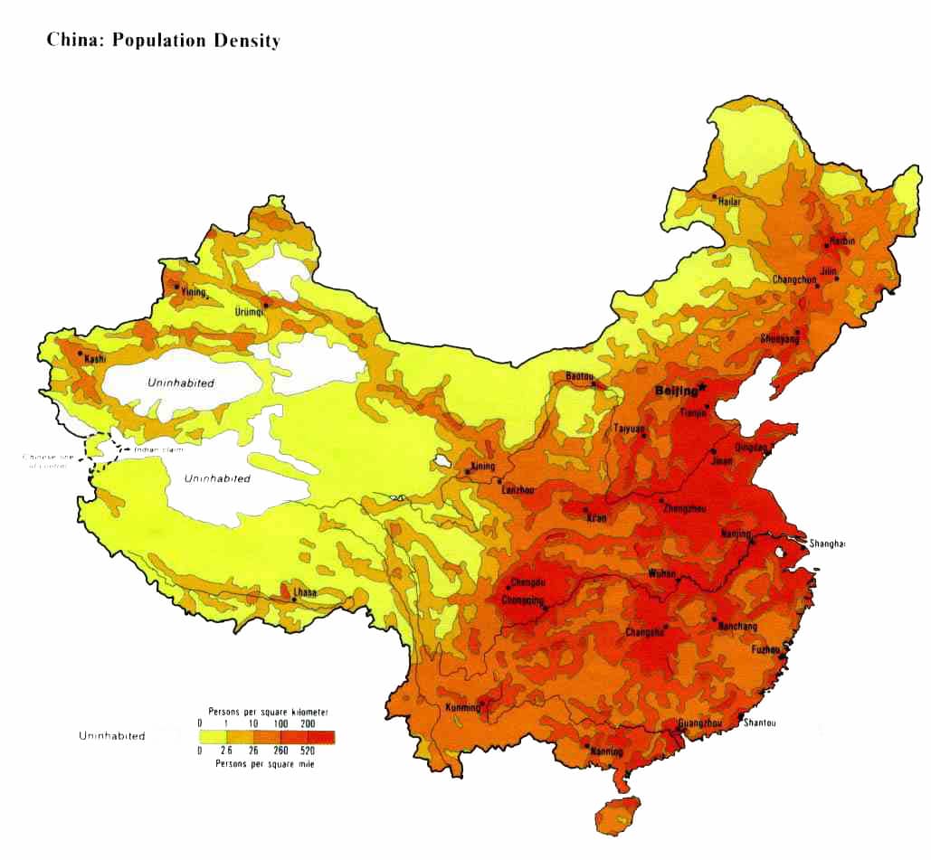
Since we can see from the elevation map that many people are located on the eastern side of China, it is important to know a few of the most populated areas of China.

The Current Hong Kong Skyline
Hong Kong
Situated on the edge of the South China Sea, Hong Kong was once a British colony, but now is part of Mainland China. More than seven million people inhabit Hong Kong, and it is one of the most influential business cities in the world. The city is changing at an incredible rate and an example of this is the Hong Kong skyline which has seen a drastic change over the past 50 years. The image below shows the change that has occurred in the past 40 years to the Hong Kong Skyline. Through this image, it is possible to see just how the city has grown to be in its powerful state of present day.


Beijing
Beijing is the capital of China and located in Northern China near the Yellow Sea. It is the political center of China, and houses many of the state-owned companies of the country. Along with being a political center of China, Beijing is also a cultural center of China. You can find many cultural sites important to China in Beijing, such as The Great Wall, The Forbidden City and The Grand Canal as well as others. The municipality of Beijing is home to more than 20 million people


Shanghai
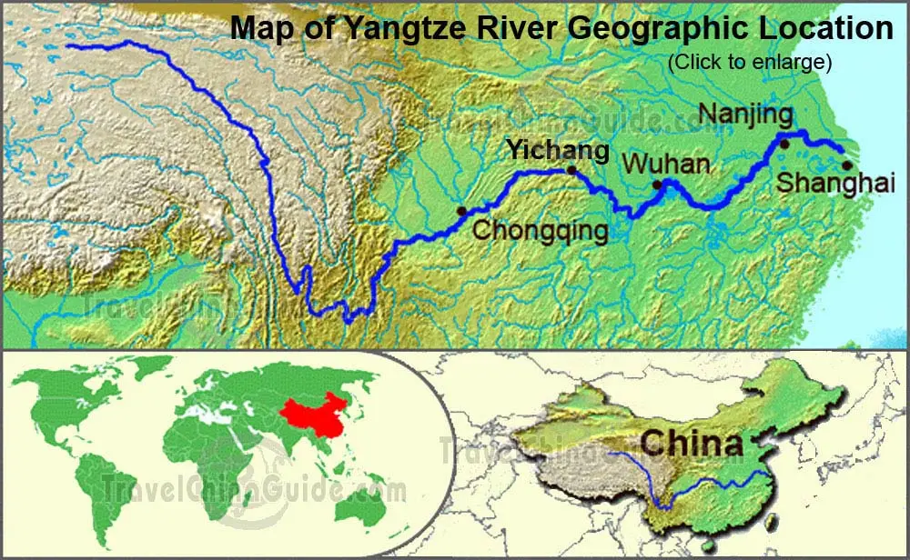
Shanghai is also a municipality of China and has the largest population in China and the world with more than 25 million people inhabiting the area. Shanghai is situated on the Yangtze River Delta. The location of Shanghai allows it to be a major shipping city and has the world's largest shipping port.


Elevations of China

Using Google Earth, I created a map of the elevations of China. China has some of the highest mountains in the world. The Himalayans are located in the Western region of China. From the map we can see that as you move across the country from the Pacific Ocean, the elevation increases. The elevation lines increase by 500 meters.

Google Maps Image of the Elevations of China. The farthest right line(purple) is 500 meters and each line moving to the left increase by 500 meters. 

When looking at a population density map, we can see that the lower the elevation, the more the population. This is due to the higher elevations being harder to live in and grow food.

The Yangtze River and the Three Rivers Gorge Damn

A geographical look at the location of the Yangtze River.
The Yangtze River is the longest River in Asia. It flows into the East China Sea in Shanghai. The Yangtze provides water for farming and living along it's banks and into it's basin. In the past couple of years, the river has been polluted by industrial and farming runoff and trash. The river is also being changed by the Three Rivers Gorge Damn that is being built. The Three Rivers Gorge Damn is creating hydro electric power for a vast part of China.


Three Rivers Gorge

Public Works Projects on the Yangtze

The Three Rivers Gorge Damn is the largest damn in the world. Although the Three Rivers Gorge Damn is supposed to produce more power for China, it as also had many implications for the country. Many people have been displaced due to the damn, as well as ecological changes happening due to the flooding of the areas around the damn.